File:Detail Sanborn Map Newark 1912 Arcade.jpg
From Licking County Library's Wiki!
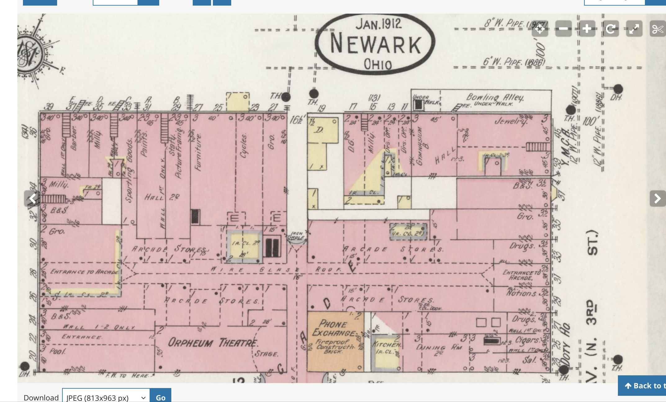
Revision as of 13:32, 12 May 2022 by LCL (Talk | contribs) (Detail of the 1912 Sanborn Fire Insurance Map of Newark, Ohio for the area around the Newark Arcade. From Library of Congress, Geography and Map Division, Sanborn Maps Collection.)
Size of this preview: 800 × 483 pixels. Other resolution: 320 × 193 pixels.
Original file (2,146 × 1,296 pixels, file size: 1.66 MB, MIME type: image/jpeg)
Detail of the 1912 Sanborn Fire Insurance Map of Newark, Ohio for the area around the Newark Arcade. From Library of Congress, Geography and Map Division, Sanborn Maps Collection.
File history
Click on a date/time to view the file as it appeared at that time.
| Date/Time | Thumbnail | Dimensions | User | Comment | |
|---|---|---|---|---|---|
| current | 13:32, 12 May 2022 | | 2,146 × 1,296 (1.66 MB) | LCL (Talk | contribs) | Detail of the 1912 Sanborn Fire Insurance Map of Newark, Ohio for the area around the Newark Arcade. From Library of Congress, Geography and Map Division, Sanborn Maps Collection. |
- You cannot overwrite this file.
File usage
The following page links to this file: