Difference between revisions of "Photos - Maps"
From Licking County Library's Wiki!
| (5 intermediate revisions by the same user not shown) | |||
| Line 4: | Line 4: | ||
wiki_LickingCounty.jpg|A map of [[Main Page|Licking County]] | wiki_LickingCounty.jpg|A map of [[Main Page|Licking County]] | ||
wiki_LickingCountyMap.jpg|A map of [[History of Licking County | Licking County]] | wiki_LickingCountyMap.jpg|A map of [[History of Licking County | Licking County]] | ||
| + | File:Refugee tracts map from Ohio Lands by Peters 1918.jpg|[[Refugee Tracts]] in Central Ohio 1801-1816 | ||
1894_map.png|A map of Licking County in 1894. See [[1851-1900]] | 1894_map.png|A map of Licking County in 1894. See [[1851-1900]] | ||
| − | File:Herbon map 1875 atlas canal and road logo.jpg | + | File:Herbon map 1875 atlas canal and road logo.jpg|Map of Hebron from 1875 Atlas of Licking County |
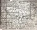
1939_Licking_County.jpg|A map of Licking County in 1939. See [[1901-1950]] | 1939_Licking_County.jpg|A map of Licking County in 1939. See [[1901-1950]] | ||
1939_Granville.jpg|A map of Granville in 1939. See [[1901-1950]] | 1939_Granville.jpg|A map of Granville in 1939. See [[1901-1950]] | ||
Revision as of 10:16, 10 September 2020
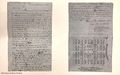
Newark's "birth certificate," created in 1803. See 1800-1850
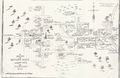
A drawing of how Newark may have appeared in 1808. See 1800-1850
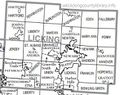
A map of Licking County
A map of Licking County
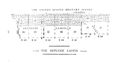
Refugee Tracts in Central Ohio 1801-1816
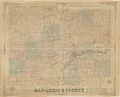
A map of Licking County in 1894. See 1851-1900
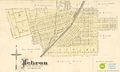
Map of Hebron from 1875 Atlas of Licking County
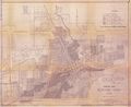
A map of Licking County in 1939. See 1901-1950
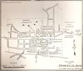
A map of Granville in 1939. See 1901-1950
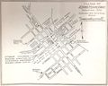
A map of Johnstown in 1939. See 1901-1950
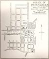
A map of Pataskala in 1939. See 1901-1950
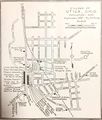
A map of Utica in 1939. See 1901-1950
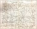
A 1950 zoning map of Licking County. See 1901-1950


