1901-1950
The Licking County Library has many maps available to the public in its Local History Vertical Files. Here is a sampling of maps showing representations of Newark as it appeared in the first half of the twentieth century.
Contents
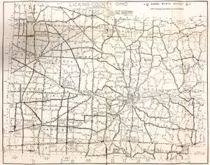
Licking County in 1939
This map shows the Rural Route System in Licking County in 1939. It also shows the State Highway System, County Road System, and the Township Road System. It was printed for the Edmiston Book Store Company, which was located at 15 S. Third St. in Newark.
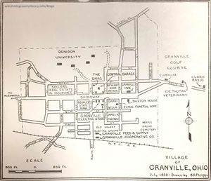
Granville in 1939
This map of Granville in 1939 is from the same map printed for the Edmiston Book Store Company.
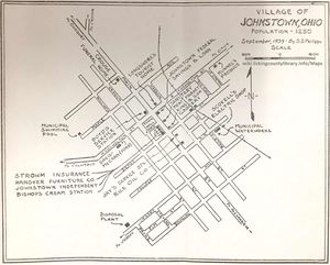
Johnstown in 1939
This map of Johnstown in 1939 is from the same map printed for the Edmiston Book Store Company.
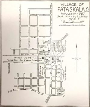
Pataskala in 1939
This map of Pataskala in 1939 is from the same map printed for the Edmiston Book Store Company.
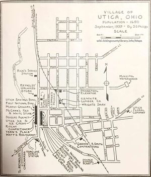
Utica in 1939
This map of Utica in 1939 is from the same map printed for the Edmiston Book Store Company.
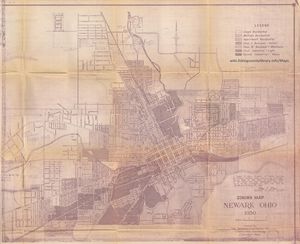
Newark in 1950
This is a zoning map of Newark in 1950.
