Difference between revisions of "1851-1900"
From Licking County Library's Wiki!
(→1894) |
|||
| Line 4: | Line 4: | ||
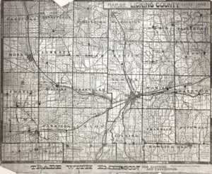
This detailed map shows Licking County and its townships. It was drawn in 1894 by Mills & Goddard, architects from Columbus, Ohio. | This detailed map shows Licking County and its townships. It was drawn in 1894 by Mills & Goddard, architects from Columbus, Ohio. | ||
| − | [[File: | + | [[File:1894_map.png|thumb|none|alt=A map of Licking County from 1894.|Licking County in 1894]] |
Latest revision as of 11:29, 2 August 2017
The Licking County Library has many maps available to the public in its Local History Vertical Files. Here is a sampling of maps showing representations of Newark as it appeared in the second half of the nineteenth century.
1894
This detailed map shows Licking County and its townships. It was drawn in 1894 by Mills & Goddard, architects from Columbus, Ohio.
