Huffman Mound
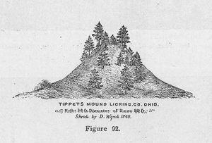
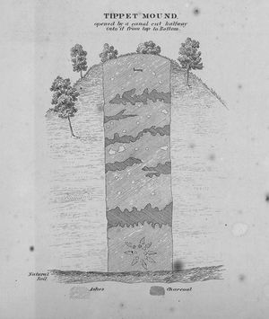
Huffman Mound, also known as Tippet or Tippett Mound, is located within Taft Reserve, a 425-acre reserve in the Licking Park District. Huffman Mound likely dates to the Adena cultural period; this is known not only from its size and shape, but also from evidence recovered at the site by an infamous amateur archaeologist in the middle of the 19th century. [1] That man, David Wyrick, who surveyed and sketched one of the earliest drawings of the layout of the Newark Earthworks, also perpetrated an archaeological hoax, creating and planting four carved stones inscribed with Hebrew markings at Native American sites in Licking County. Wyrick’s work at Huffman indicated that the site was used for burials. The mound was well-known in the nineteenth century, as were its excavations, [2], though the excavations damaged the mound, reducing its height slightly. Today the mound is around 20 feet in height and 200 feet in diameter and, according to Susan Woodward and Jerry Mcdonald’s book, Indians Mounds of the Middle Ohio Valley, it should be visible from nearby hiking trails. [3] Another mound, called Rutledge Mound, sits close to Huffman Mound within the Taft Reserve.
J.G.
Return to Historic Sites and Buildings

