Difference between revisions of "McKean Township"
| (4 intermediate revisions by the same user not shown) | |||
| Line 1: | Line 1: | ||
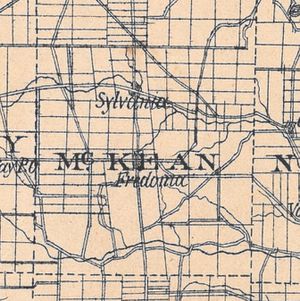
| − | McKean Township—situated in central Licking County—lies south of [[Burlington Township]], west of [[Newton Township]], north of [[Granville Township]], and east of [[Liberty Township]]. | + | [[File:Mckean township hills 1881.jpg|thumb|Detail of McKean Township from ''Hill's History of Licking County''.]]McKean Township—situated in central Licking County—lies south of [[Burlington Township]], west of [[Newton Township]], north of [[Granville Township]], and east of [[Liberty Township]]. |
| − | + | McKean Township is comprised of rolling hills covered in forest and farmland and crossed by the Clear Fork and the Brushy Fork of the Licking River. It has a two small communities. | |
==Moundbuilders and Native American settlement== | ==Moundbuilders and Native American settlement== | ||
| Line 24: | Line 24: | ||
J.G. | J.G. | ||
| + | |||
| + | |||
Return to [[Townships and Communities]] main page. | Return to [[Townships and Communities]] main page. | ||
==References== | ==References== | ||
Latest revision as of 05:37, 5 April 2022
McKean Township—situated in central Licking County—lies south of Burlington Township, west of Newton Township, north of Granville Township, and east of Liberty Township.McKean Township is comprised of rolling hills covered in forest and farmland and crossed by the Clear Fork and the Brushy Fork of the Licking River. It has a two small communities.
Contents
Moundbuilders and Native American settlement
McKean had a handful of small mounds and a single enclosure that date to the county's prehistory [1]. The circular enclosure, or "fort," was located in the northwestern portion of the township and enclosed around an acre of land. This enclosure and the smaller mounds have largely been eroded and destroyed through agricultural use of the land. A Native American encampment was reported on a tributary of the Brushy Fork early in the nineteenth century. It was in use as late as 1820, but only unoccupied native dwellings were recorded after that date. [2]
Early European Settlement
John Price, a Welshman who settled near the border with Granville Township, was McKean's first European settler in 1806. The presence of Price extends the band of Welsh settlement in Licking County northward from its concentration in Granville Township and Newark Township. A larger wave of settlers and families arrived in 1810, leading to the establishment of a grist mill near the Newton Township line in 1812. Growth in the 1810s led to the establishment of McKean as a township in 1818. Thomas McKean Thompson, an early settler of substantial wealth, gave the township its name. Thompson would serve as a Licking County commissioner from 1822-1825, but had previously held the position of private secretary to Governor Thomas McKean of Pennsylvania, who served as the township's namesake. [3]
Fredonia and Sylvania
Centrally located in the township, the village of Fredonia was founded in 1829 by Spencer Arnold, David Wood, and Samuel Shaw. Fredonia never attained a population much greater than one-hundred inhabitants, rising to 107 in 1840. A post office was established in 1837. By the 1960s, the population had dwindled to a few dozen residents and several businesses. [4] Sylvania, or Highwater, was developed in northern McKean Township in 1838 by Jesse and Abraham Gosnell. Sylvania, like Fredonia, never expanded beyond its modest origins. It acquired a post office in 1851 only to lose it in 1858. When the village went to reapply for a post office in the 1880s, they discovered that another Sylvania in Lucas County, Ohio had taken the name. Therefore, they changed the name of their village to Highwater to avoid confusion. [5]
Underground Railroad
James Conrad Wright and Edwin Runnel of McKean Township were both active in the Underground Railroad system that guided escaped slaves to safety in northern U.S. States and Canada. James Wright reportedly served as a conductor on the railroad, while Runnel's farm near Highwater served as a station for those seeking their freedom. [6] McKean Township would have served as a conduit further north from Granville, Ohio, a well-known hub for Underground Railroad activities and abolitionists.
For more information see also:
J.G.
Return to Townships and Communities main page.
References
- ↑ Mill, W. Archaeological Atlas of Ohio, (1914), 45
- ↑ Hill, N., History of Licking County, (1881), 514
- ↑ Hill, N., History of Licking County, (1881), 515
- ↑ Ohio Ghost Towns: No 44 Licking County, ed. Helwig and Helwig, (1998), 76
- ↑ Ohio Ghost Towns: No 44 Licking County, ed. Helwig and Helwig, (1998), 146; Hill, N., History of Licking County, (1881), 515
- ↑ Jackson, R., A Photographic View Book of the Underground Railroad Stations in Licking County, Ohio, (2008), 67-68
