File:Madison township 1866 atlas.jpg
From Licking County Library's Wiki!
Size of this preview: 541 × 599 pixels. Other resolution: 217 × 240 pixels.
Original file (4,118 × 4,561 pixels, file size: 4.11 MB, MIME type: image/jpeg)
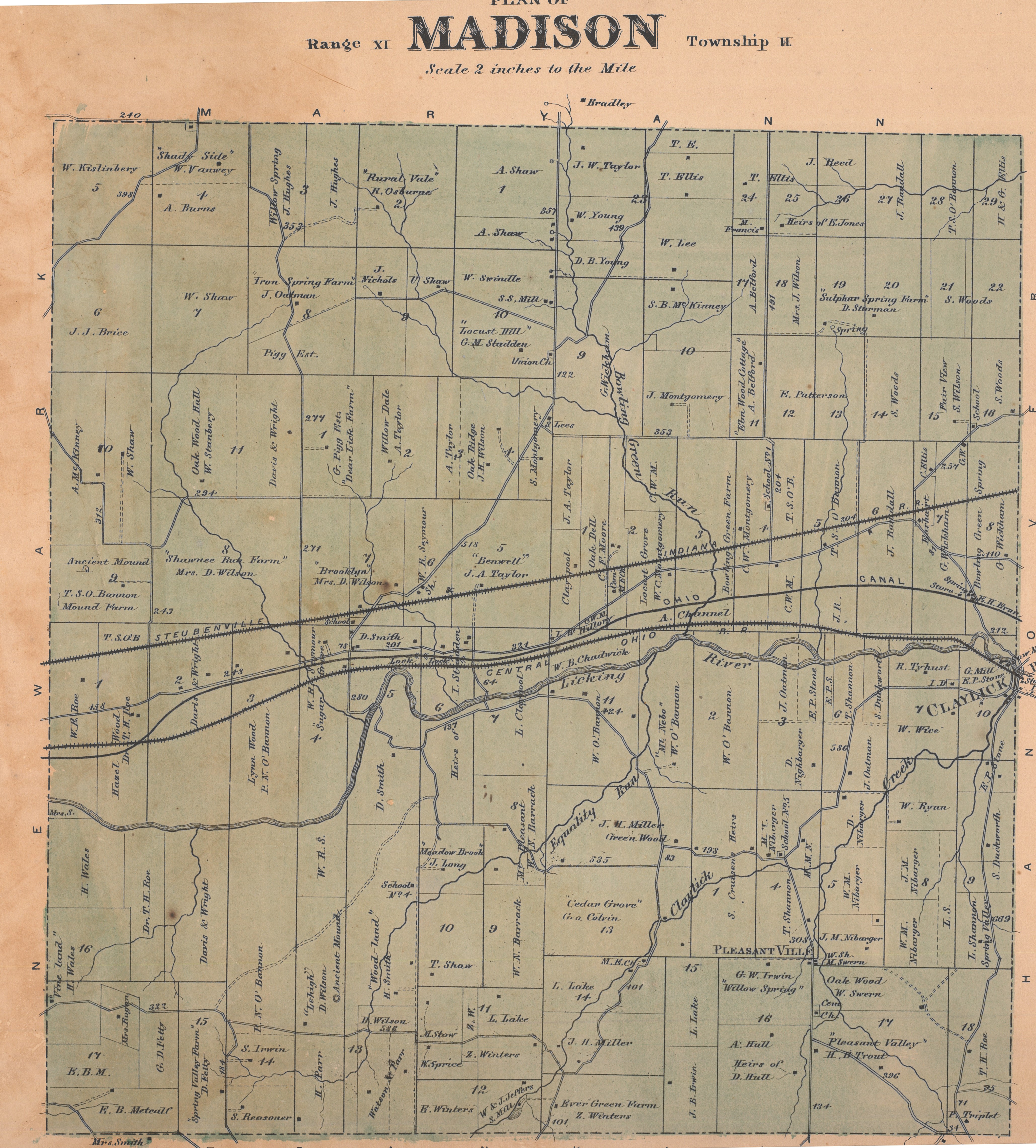
Map of Madison Township as it appeared in the 1866 Atlas of Licking County.
File history
Click on a date/time to view the file as it appeared at that time.
| Date/Time | Thumbnail | Dimensions | User | Comment | |
|---|---|---|---|---|---|
| current | 12:32, 10 December 2021 | | 4,118 × 4,561 (4.11 MB) | LCL (Talk | contribs) | Map of Madison Township as it appeared in the 1866 Atlas of Licking County. |
- You cannot overwrite this file.
File usage
The following page links to this file: